When the Ground Shifts: How Erosion, Flooding, and Natural Disasters Are Quietly Redrawing American Property Lines
For most homeowners, a property survey feels like a permanent declaration — a definitive record of where your land begins and where it ends. That assumption, however, rests on a foundational premise that climate-related environmental change is steadily eroding: that the ground itself stays put.
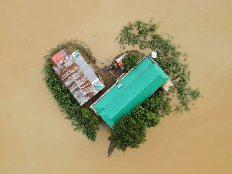
Across the country, flooding events are depositing new sediment along riverbanks, coastal storms are swallowing beachfront lots whole, and wildfires are destabilizing hillside soils in ways that invite catastrophic landslides. In each of these scenarios, the legal question is the same — and the answer is rarely simple: when nature moves a boundary, who owns what remains?
The Legal Framework Was Built for a More Stable World
American property law inherited its foundational boundary concepts from English common law, a tradition developed in a climate far more temperate than the one now reshaping the American West, Gulf Coast, and Appalachian corridor. Two ancient legal doctrines — accretion and avulsion — govern how courts determine ownership when water or land movement alters a boundary. Understanding the distinction between them is essential for any property owner living near a river, coastline, or unstable terrain.
Accretion refers to the gradual, imperceptible accumulation of sediment or soil along a property's edge. Under long-standing common law principles, land gained through accretion typically belongs to the adjacent landowner. If a riverbank slowly extends into the water over years or decades, the property owner generally gains that new land.
Avulsion, by contrast, describes a sudden, dramatic shift — a flood that reroutes a river overnight, for example, or a storm surge that instantaneously removes a substantial portion of a coastal parcel. In avulsion events, courts have historically held that the original boundary line remains legally fixed, even if the physical geography has changed dramatically. The land may be gone, but the legal boundary remains where it was.
The practical problem for modern homeowners is that climate change is increasingly blurring the distinction between these two categories. A slow-moving flood that persists for weeks, progressively reshaping a streambank, may not fit neatly into either classification. Courts in different states have reached different conclusions, and the resulting patchwork of case law offers little comfort to property owners seeking certainty.
Coastal Property: The Frontline of Boundary Instability
Nowhere is the tension between legal boundaries and physical reality more acute than along the American coastline. States including Florida, Louisiana, North Carolina, and California are grappling with accelerating shoreline retreat driven by a combination of sea-level rise, increased storm intensity, and sand depletion.
In many coastal states, the public trust doctrine creates a moving legal boundary at the mean high-water mark — the line separating private beachfront property from publicly accessible shoreline. As that line migrates landward with rising seas, private property can effectively shrink without any formal legal proceeding. Homeowners who purchased what appeared to be substantial beachfront lots have found, over time, that their usable private land has diminished significantly.
Louisiana presents perhaps the starkest example in the continental United States. Coastal land loss in that state has proceeded at a rate that makes boundary disputes almost routine — entire parishes have seen land simply disappear into the Gulf of Mexico. The legal status of submerged land that was once privately owned remains a subject of active litigation and legislative debate.
Inland Waterways and the Problem of Moving Rivers
Rivers and streams have always served as convenient natural boundary markers, and their use as legal property dividers is embedded in deed language across rural America. The difficulty is that rivers move — and in an era of intensified rainfall events and altered snowmelt patterns, they are moving more aggressively than historical records would suggest.
When a stream that forms a property boundary shifts course after a significant flood, the question of which doctrine applies — accretion or avulsion — can determine whether a landowner gains or loses acres of productive farmland or developable real estate. In agricultural states such as Iowa, Missouri, and Nebraska, disputes over river-boundary shifts have generated substantial litigation, with courts sometimes reaching opposite conclusions on nearly identical fact patterns.
For rural landowners in particular, the recommendation from property law practitioners is consistent: do not assume that a deed referencing a river or stream as a boundary means that boundary is stable. Periodic re-surveys are advisable, especially following major flooding events.
Landslides, Wildfires, and the Emerging Frontier of Disaster-Driven Disputes
While water-related boundary changes have the longest legal history, fire and slope instability are creating a newer category of dispute that the law is still developing tools to address.
In the aftermath of destructive wildfires — particularly in California, Oregon, and Colorado — denuded hillsides frequently become vulnerable to debris flows and landslides during subsequent rain events. When a landslide deposits material onto a neighboring property, or when a slope failure removes land from one parcel and deposits it onto another, the legal questions can become extraordinarily complex. Is this accretion? Trespass by a natural force? Does the uphill neighbor bear any liability for conditions that made the slide more likely?
These questions do not yet have uniform answers across American jurisdictions. What is clear, however, is that the frequency of these events is increasing, and the legal system will be required to develop more consistent frameworks for resolving them.
Why Your Survey May Already Be Outdated
Most homeowners obtain a property survey at the time of purchase and assume its findings are durable. In stable terrain with no proximity to water, that assumption may hold for decades. In areas subject to any of the forces described above, however, a survey conducted ten or even five years ago may no longer accurately reflect physical conditions on the ground.
Licensed land surveyors increasingly recommend that property owners in flood-prone, coastal, or geologically active areas treat surveys as time-sensitive documents rather than permanent records. Following any significant natural event — a major flood, a documented landslide, a severe storm — a re-survey is a prudent investment. The cost of confirming your boundaries is substantially lower than the cost of litigating them after a dispute has already crystallized.
Additionally, homeowners should review their title insurance policies carefully. Standard policies typically exclude coverage for boundary changes resulting from natural forces, meaning that a landowner who loses acreage to erosion or a shifted riverbank may find little recourse through their insurer.
Practical Steps for Property Owners in Vulnerable Areas
For those whose land lies in areas susceptible to climate-driven boundary changes, several proactive measures are worth considering:
- Document your boundaries regularly. Photographs, GPS coordinates, and professional surveys create a baseline record that can be invaluable if a dispute later arises.
- Consult a real property attorney in your state. The applicable legal doctrine varies significantly by jurisdiction, and general principles do not substitute for state-specific legal advice.
- Monitor local government flood mapping updates. FEMA's Flood Insurance Rate Maps are periodically revised, and changes to flood zone designations can affect both property values and legal boundary determinations.
- Engage your neighbors proactively. When natural events alter shared boundaries, early communication can sometimes prevent disputes from escalating into litigation.
- Review deed language carefully. Deeds that reference natural features as boundary markers — rivers, ridgelines, shorelines — warrant particular scrutiny in the current climate environment.
A New Kind of Boundary Dispute
The disputes that FenceOff has long documented — the misplaced fence, the encroaching driveway, the contested survey pin — arise from human decisions and human errors. The boundary disputes now emerging from environmental change are different in character: they arise from forces no individual property owner controls, governed by legal doctrines that were not designed with a destabilizing climate in mind.
That does not make them any less consequential. For the homeowner whose backyard is slowly sliding into a creek, or whose beachfront has retreated by thirty feet since purchase, the financial and legal stakes are entirely real. Knowing that the ground beneath your property can shift — and understanding what the law does and does not offer when it does — is, increasingly, a fundamental component of responsible property ownership in the United States.